This is Part 2 of 4. Click for Part 1, Part 3, or Part 4.
Day 5
Gavurağili – outskirts of Kumluova
15 km [+extra 8 km from getting lost] (8 hours)
We woke up, packed up our freshly laundered clothes, and indulged in a large Turkish breakfast of bread, olives, tomatoes, cucumbers, olive oil, honey, butter, and jam. To our surprise, Mayhem was waiting outside the gate. Her whole body wagged hello and we shared some more bread with her. There was no denying it anymore… she had adopted us. We might as well feed her then. We felt really good as we set out walking.
It was supposed to be an easy walking day. There was one hill to climb at the beginning, then an equal descent. From there, it would be mostly flat.
Setting out on the trail
We lost the trail almost immediately after leaving, but realized that if we followed the road we were on, we should meet up with it at some point. So we carried on instead of doubling back in search of waymarkers. Sure enough, we eventually came across the trail and left the road on it. Something seemed wrong about the direction, but I ignored the gut feeling I had and we carried on.
As we climbed over and around rocks on the trail, we saw a young couple coming towards us. These were the first hikers we had seen on the trail since leaving Fethiye. We quickly questioned each other to find out where they were from (Sweden), where they started (Fethiye), how long they’ve been hiking the trail (2 weeks), and how far they planned to go (to Antalya if they could). We asked where they were aiming for today. They said Xanthos. Oh dear. That’s where we were headed. But we met each other headed in opposite directions.
After consulting the map (which we didn’t do when we met up with the trail in the first place), we realized we had got on the trail headed in the wrong direction. We should have known when we started climbing a hill again. We had been hiking for over two hours and the Swedish couple (who had camped about where we had started) had only been on the trail for about 45 minutes. We were almost back where we started the day! Argh.
Mike figured that if we carried on in the wrong direction and took the road we inadvertently took the first time, we would actually save ourselves some time (since the road was relatively easy walking and meandered less than the trail). So we said farewell to the Swedes and continued hiking in the wrong direction.
After quite some time of this, I started doubting Mike’s logic. I walked along, stewing about having to climb the hill for the third time… The more I walked, the more sure I was that it would have been a hell of a lot quicker to follow the Swede’s in the correct direction.
Angry and frustrated, we eventually made our way back to the spot where left the road to take the trail the first time. About 100 m after that spot and around a bend, were the bright yellow junction markers of the Lycian Way that would have put us in the right direction. Double argh. We figured we lost about 2 hours or 8 km on the whole endeavour.
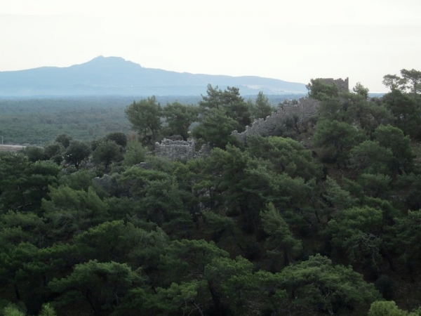
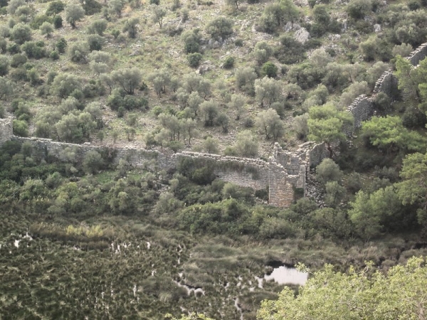
Pydnai ruins
Pydnai ruins
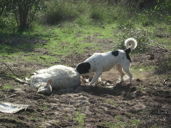
We got on the proper trail and went down into Pydnai ruins. Not surprisingly, we lost the trail in the ruins and wandered all over the overgrown area until we found the way out. The trail turned into a rather dire, empty road – complete with a dead sheep.
Mayhem makes a meal out of Dolly
Later, at a break, we cheered up a little when the Swedish couple appeared. As it turns out, Mike was right about saving ourselves time by going backwards. We had actually gotten ahead of them.
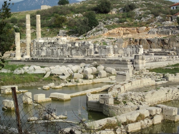
The trail disappeared among some road construction, but we were able to ask the construction workers the direction to the Letoon ruins. We chatted with the Swedes while we walked. We arrived in Letoon and walked past the ruins, deciding not to pay the entrance since the site was quite visible from the trail.
Letoon
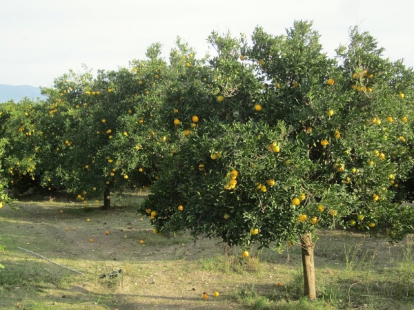
Orange trees, bursting with fruit
Mike’s ankle started acting up and became sorer and sorer as we continued to walk. Eventually, upon reaching a field between Kinik and Kumluova he had had enough. We set up our camp. A Turkish woman appeared. Through our phrasebook and sign language, we managed to understand that her sheep were grazing in the field and she didn’t want us camping there with the dog. She suggested we go to Patara or Letoon for the night. We explained that we had just come from Letoon and were on foot, so we needed to camp where we were. She told us we could camp there for 5 lira and we agreed. I ran back to the tent to get the money, but as I was grabbing it she left with her sheep and didn’t return.
Day 6
Outskirts of Kumluova – valley past Înpinar Spring
12 km (8 hours)
It rained all night and we woke to the sound of a bubbling spring that wasn’t there the night before. It was quite loud and as we emerged from our sleepy state we realized our air mattresses were practically floating. The entire floor of the tent was covered in water. We quickly realized why – the stream we were hearing had appeared directly under our tent. What we thought was an old goat path that we set the tent up over was actually a waterway. We quickly jumped up and set about packing up our wet things.
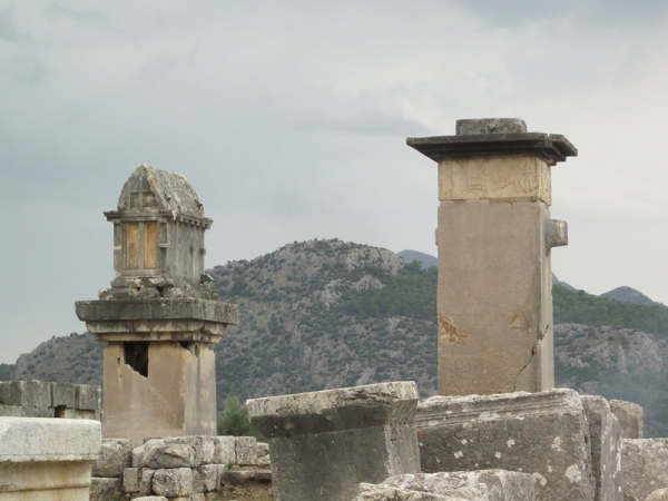
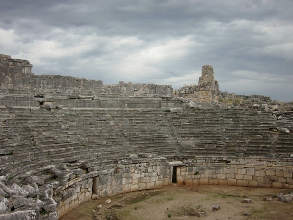
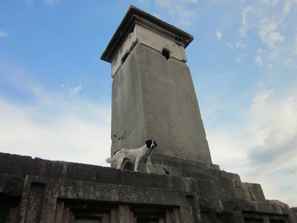
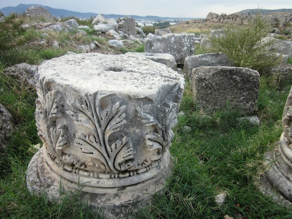
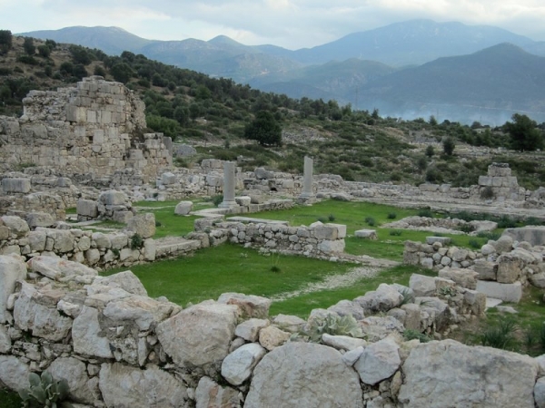
Cold and a little wet, we snacked on a few bits of food while we started walking towards Kinik. There, we bought fresh bread and Aryan (a delicious, salty watered-down yogurt drink) and feasted on it at the Xanthos ruins just outside of town. We spent an hour or so exploring the ruins, while Mayhem played with a new canine friend she made at the entrance.
Xanthos ruins
Xanthos ruins
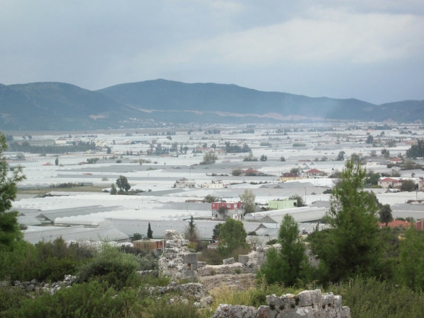
Some of the many, many greenhouses that call these parts home
Mayhem was never too far away
Xanthos ruins
Xanthos ruins
We couldn’t pick up the trail from the ruins, but knew that the road should get us where we were going. We met up with the trail before the next town, Çavdir, but lost it yet again at the graveyard on the way out of town.
The guidebook told us to turn left at the graveyard exit onto a wide, well-groomed path that rises alongside the graveyard wall. There was a narrow but distinctive trail to the left along the wall, so we followed that. We ended up in the adjacent field, with no trail and no waymarkers in sight. We spent two hours combing the field for signs of the trail until our morale was at an all-time low. We couldn’t find the path, nor the traces of the aqueduct that were supposed to be our “route finders for the next few hours.”
We finally decided to retrace our steps to the graveyard exit and search for the path there. That’s when Mike realized that “turn left” actually meant “go straight.” We found the trail, a wide road that did not follow the graveyard wall at all, but rather went straight away from it.
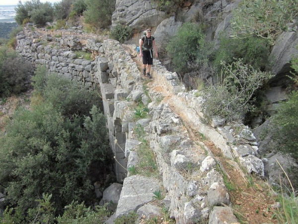
We trudged on, angry and frustrated at the loss of time and ambiguousness of the guide’s directions. There was still no sign of an aqueduct. After quite some time, we finally encountered the fabled aqueduct and our spirits lifted a little.
It really does exist!
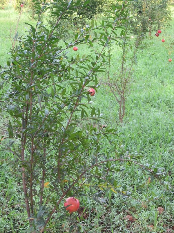
As we followed it, we came across some wild pomegranate trees loaded with ripe fruit. They did not appear to be tended, as much of the fruit was falling to the ground and rotting, so we helped ourselves to a bagful of it. This treat lifted our morale further, and we carried on, much happier.
Pomegranate trees (not the wild ones we scavenged, but you get the picture
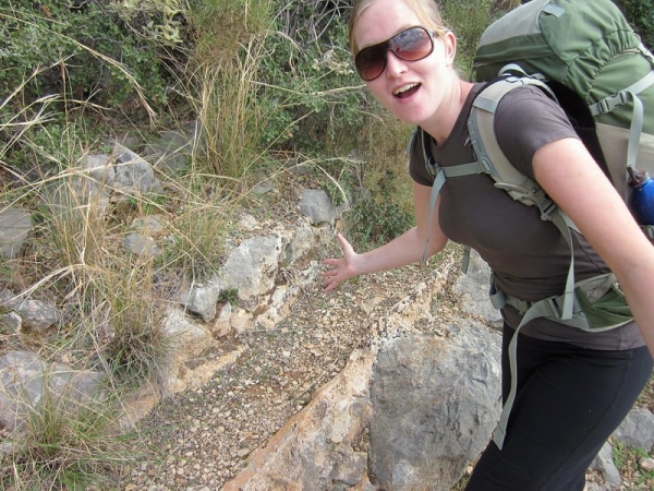
We found ourselves hiking on a steep hillside on top of the actual aqueduct, precariously balancing with our loaded packs and bag of heavy pomegranates while only a crumbling lip of rock kept us from sliding down the cliff.
Walking along the aqueduct… tread carefully!
We found a great, flat, grassy patch at about 2:30 pm that looked like paradise. I suggested we quit early and relax after a tough day. Mike disagreed, wanting to trudge on and gain some more ground after all the time lost earlier in the day. So we did.
Continuing to follow the aqueduct, which was running with spring water at this point, we kept hiking. On a particularly wet and slippery bit, I suggested to Mike that he hand the bag of pomegranates to me to have better control of his balance. He tossed it at me and I, of course, missed them – the fruits went rolling down the slope, into the aqueduct, and out of sight in the stream of water. We managed to salvage two and half of them. Again, our morale plummeted to a new all-time low. This wasn’t helped by the fact that we had once again lost the waymarkers.
We spent 30 minutes searching for the trail at the top of the valley. Once we crossed the valley, we spotted a tent on the terraced fields. We were surprised to see another hiker on the trail – there hadn’t been anyone since the Swedes. The tent’s Muslim occupant was engaged in prayer, so we quietly walked past so as not to disturb him. Just around a bend, we found our own “pseudo-paradise”… as in, “It’ll do”. I felt a little bad camping so close to the other hiker, but we were tired, it would be dark soon, and there was no telling where the next flat spot would be. We set up camp, well aware that despite spending all day hiking along running spring water, our water supplies were running low.
We survived a tough day… just barely
Day 7
Valley past Înpinar Spring – Delikkemer
15 km [+2 km from getting lost] (8 hours, 15 minutes)
Mayhem barked all night again. Now I was feeling really guilty about camping so close to the other hiker – he surely was on his own for some peace and quiet, not to listen to a dog yap all night.
We hiked down to the next village, Üzümlü, and restocked on groceries. We filled up our empty water bottles at a local water faucet. As we left the grocery store, we caught sight of the other hiker – he had caught a mini-bus into town and was having a cup of çay.
He asked if the dog was ours and after explaining how she had been following us for several days, we apologized for the noise she had made the night before. He told us no apology was necessary and that he wished he had a dog like that – apparently she was quite clever and had been barking to scare off the wild pigs around his tent! So we were right – she was protecting us all along.
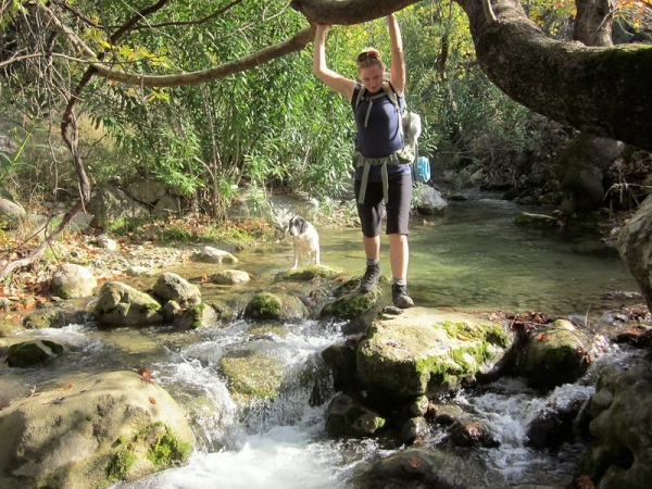
As we hiked the trail, we got lost after crossing a stream. Learning our lessons from the times past, we only spent about 10 minutes searching before going back to our last known waymarker. We found the trail and continued into the village of Akbel.
Crossing the stream
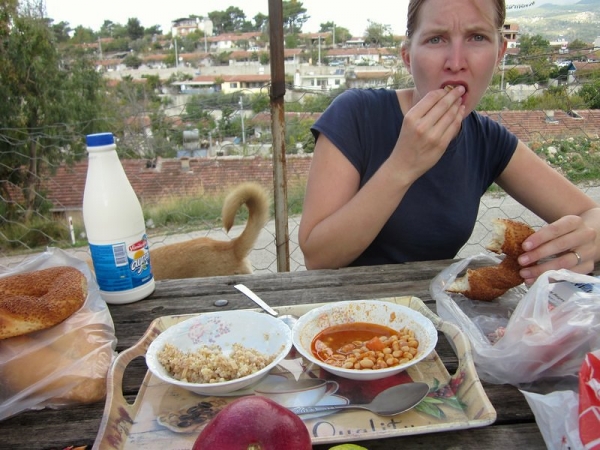
In Akbel, we bought ourselves a can of beans, some Ayran, and some bread. We found a comfortable picnic table outside of the local mosque to eat it. As we started eating, the Imam came over to us with a tray of hot tomato and bean soup and bulgur wheat. We thanked him greatly and enjoyed the warm meal.
Before we got out of town, we had picked up another dog. We tried to get him to leave, but he was having none of it. One dog was enough for us to take care of, so we did our best to ignore him.
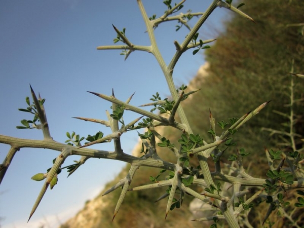
The trail turned rough between Akbel and Delikkemer. In fact, it was lined with scratchy, thorny plants on either side. They were calf to knee-height and had grown over the trail enough that they scratched our legs with each step. I was wearing capris that ended just below the knee and Mike was in shorts. We kept debating whether we should stop and change into pants, but we didn’t expect the scratchy shrubs to continue for very long. We were on a groomed hiking trail, after all. So we gritted our teeth and powered through them – for around two hours.
My calves and shins felt were red, raw, and scratched – they felt like they had been flayed. To help matters out, somewhere along the way I slipped on some wet rocks and found myself nursing a sore leg and arm.
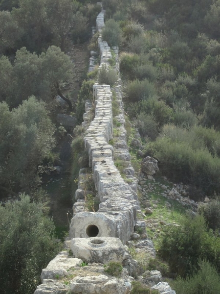
When we got to Delikkemer, I had a migraine. I was too stubborn to quit early for the day though, so I convinced Mike (and myself) that we should press on. We snapped a few photographs of the siphonic water system there and trudged ever forward.
A once-sealed 2000-year-old siphonic pipe at Delikkemer
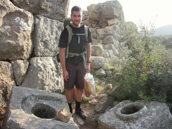
Mike and a few stones from the pipe
From Delikkemer, there is an optional loop that leads to the Patara ruins, or you can continue on towards the resort town of Kalkan. We wanted to see the ruins, so we thought we’d go as far as we could on the loop. Letting Mike take the lead, I settled in to follow with my head pounding. As we started out, he commented how well-marked the trail was here and how it was a nice treat. The shrubs on the trail continued to scratch up our legs.
With my now overwhelming headache, I was slow to think and move. I slipped on a rock and fell backwards. Luckily, I managed to stick a hand out to break my fall. Unluckily, there was a thorny bush directly under it. I sat there in shock, tears forming in my eyes, as I assessed the damage.
My hand started to throb almost instantly and I realized that each of the thorns had a hard, sharp, black tip that broke off if “attacked.” My hand had a few dozen of them embedded in the skin. I picked out all that I could, but there were still a dozen embedded so deeply I couldn’t reach them. I picked myself up and we carried on our way.
The type of plant I fell on
Consumed with my swelling and aching hand and throbbing head, I wasn’t really noticing the terrain around us. We came to some sharp, jagged rocks with deep chasms between them. The waymarkers continued here, so we started another precarious balancing act hopping from one to the next.
Finally, Mike stopped and questioned the trail – “How far does it continue like this?” he said. “This is downright dangerous.” Something about his comments clicked in my head.
I remembered reading about the trail between Delikkemer and Kalkan and how there is a precarious cliff path along the coast that you shouldn’t attempt with your rucksacks. The guide recommends sending your packs ahead by bus if you hope to attempt this part of the trail, or hike to the highway and hitch a ride to Kalkan. But we weren’t heading to Kalkan yet. We were supposed to be heading to Patara.
This is the problem with having one person do most of the map and guidebook reading in advance, and then having that same person be more or less mentally incapacitated by a migraine while the other person leads. Mike hadn’t looked at the map in a while and had little idea that the trail branched in three at Delikemmer (two branches of the Patara loop and one to Kalkan). He had just followed the only trail he saw, not thinking to search for another one.
If I had not had a headache, I would have been able to communicate this with him and would have realized instantly that we were following the wrong path (since it was along the coast) – but it was what it was. We were on the totally wrong path. We backtracked immediately, spending almost an hour getting back to Delikemmer, where we set up camp.
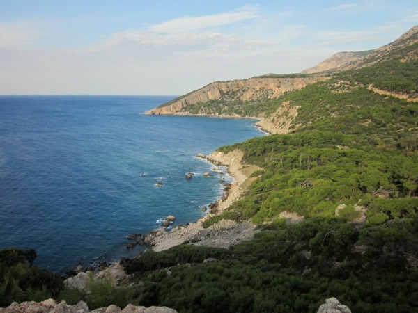
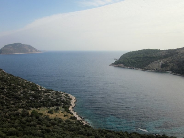
View from our camp



Djeez, I’m sorry, but it alls ounds quite awful.
I hope you’ve got to enjoy at least some bits of it up until now.
Reading this report, howeveer, makes me not want to do that trip!
Oooo… don’t think that. As long as you enjoy hiking, this trail is something to seriously consider doing. There were some pretty awful moments on the hike, but they were usually just that – moments. The great moments far outweighed them – the stunning scenery, the incredible locals we met and their kindness, the peace and solitude of trekking and camping in places where we wouldn’t see a living soul (well, other people, anyways) for hours, and the sense of personal accomplishment. It was definitely a challenging trek and one that shouldn’t be started with light consideration, but after everything we went through – I would do it all over again and even hope to one day (hopefully, I’d learn from some of our mistakes the second time through).
Glad to read that:-)
I can believe the feeling of personal accomplishment must have been great.
And also the fact that you got to do it as a couple, because it does seem like something that could turn out as a real test, no?